The Two Maps of South Louisiana
There is the South Louisiana on the highway map, and the one you see from the water. They are not the same place.

At night, the Mississippi can fool you.
From the New Orleans riverfront, the city throws its light across the water in gold and red. A sternwheeler glows against the skyline. Somewhere upriver, a towboat works against the current. A foreign-flagged ship moves quietly past terminals, warehouses and neighborhoods where most people are already asleep.
From shore, it is beautiful.
From the water, it is information.
The running lights mean something. So does the wake. So does where a vessel is anchored, which way a tow is moving, which canal a workboat disappears into, and whether a boat is tied somewhere it normally is not.
The scenery has not changed. The information has.
There are two maps of South Louisiana.
One is familiar: Baton Rouge, New Orleans, Lake Pontchartrain, the Mississippi River, the bayous and the narrow pieces of land reaching toward the Gulf.
The other is a network.
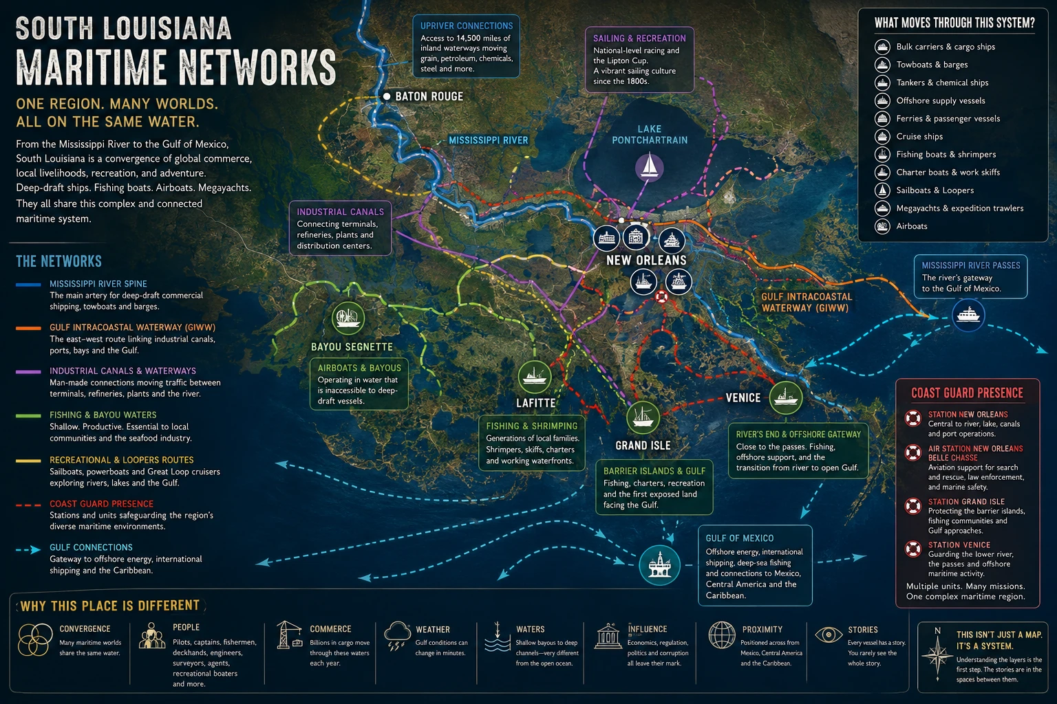
A blue-water bulk carrier coming upriver can share the same greater maritime system with a tow pushing barges, a ferry crossing the Mississippi, a cruise ship leaving New Orleans and a sternwheeler carrying tourists past the French Quarter.
That overlap is not theoretical. On 17 August 2026, the cruise ship Carnival Valor, inbound to New Orleans before dawn with nearly three thousand passengers aboard, had to make an emergency maneuver after a cargo vessel lost power ahead of her. Passengers experienced a sudden list severe enough to send pool water into interior spaces.
To the passengers, it was an unexpected moment in a vacation. To the bridge team, it was something else entirely: two very large vessels, limited water, changing circumstances and very little time.
That is the second map.
The scenery may look calm. The system never stops moving.
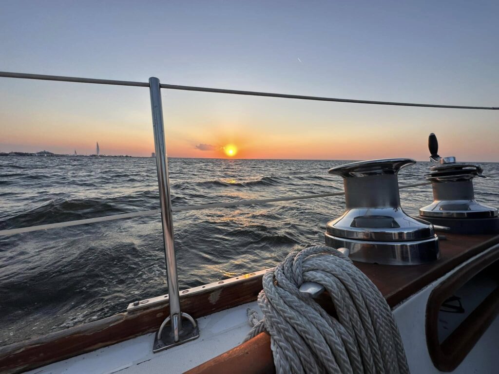
Move away from the river and the boats change with the water. Around Venice, Lafitte and Grand Isle, shrimpers, fishing boats, charter boats and work skiffs become part of the landscape. Near Bayou Segnette, airboats work water that would stop a deep-draft vessel cold. On Lake Pontchartrain, generations of sailors have raced competitively, including for the Lipton Cup.
Then there are the canals. The Gulf Intracoastal Waterway and a web of industrial and natural waterways cut across the region, creating routes that barely register on a highway map. To the people who use them, they are highways.
Tugs. Barges. Crew boats. Workboats. Sailboats. Powerboats.
Great Loop cruisers pass through on journeys measured in months. Megayachts reposition between seasons. Expedition trawlers arrive from hundreds or thousands of miles away. Offshore vessels move between docks and operations in the Gulf. A shrimp boat may represent generations of one family’s livelihood.
The water does not separate these worlds neatly.
It mixes them.
That convergence is what fascinates me. I tend to look at places from several directions at once.
A captain sees weather, current, traffic, depth and consequence. A merchant mariner sees cargo, schedules, crews and the machinery required to move something from one side of the world to another. A strategist sees systems: where responsibility changes hands, where information moves cleanly and where it does not, how something seemingly small in one part of the system can create consequences somewhere else entirely. A leader eventually sees the people underneath all of it.
Someone makes the call. Someone catches the mistake. Someone knows the local water well enough to recognize that something does not belong.
And then the writer starts asking questions.
Why is that vessel there? Where did it come from? What is aboard it? Who is expecting it? Who knows the whole story?
Usually, no one does. That may be the most interesting part of the second map.
One person understands the cargo. Another understands the vessel. Someone knows the paperwork. Someone else knows the terminal. A pilot knows the river. A towboat captain knows which fleet normally occupies which stretch. A fisherman recognizes a boat before he can read the name on its transom.
People who spend their lives around working water develop an instinct for what belongs. Sometimes the first indication that something is wrong is nothing more sophisticated than:
That boat is not normally there.
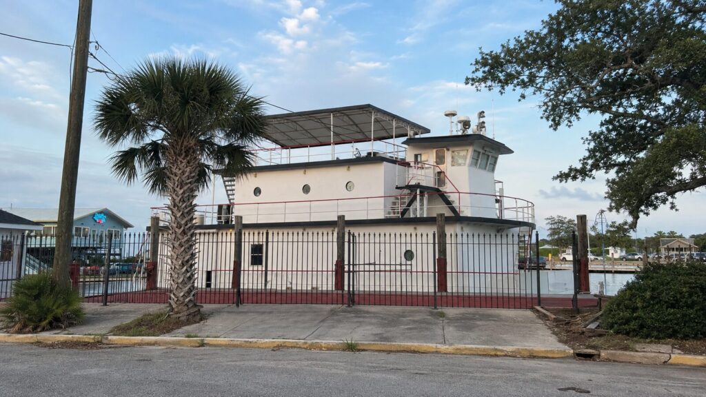
The complexity is visible in the institutions built around the water, too. Coast Guard stations and units throughout the region work dramatically different missions within a relatively small geographic area: commercial shipping, fishing, recreational boating, search and rescue, port security, offshore operations and the approaches to the Mississippi.
The missions change because the water changes. So do the people.
River pilots. Towboat captains. Deckhands. Fishermen. Ship agents. Linehandlers. Surveyors. Terminal workers. Offshore crews. Charter captains. Sailors from around the world. All of them occupy portions of the same system.
New Orleans adds another layer.
Grit.
This city has always been good at polishing its mythology without sanding off the rough edges. The river does much the same thing.
From across the water at night, New Orleans can look almost perfect. Gold light reflected on black water. A glowing skyline. Ships sliding quietly past.
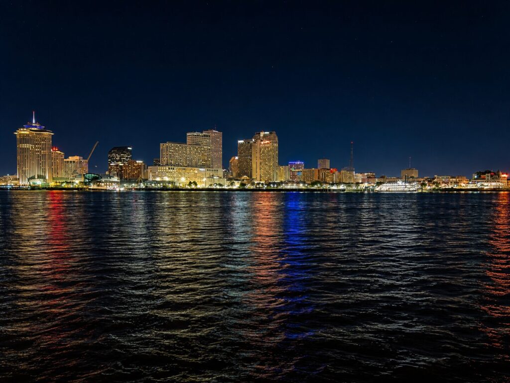
Get closer and there is mud, rust, diesel, heat, industry, labor, money and history. The grit of New Orleans is not washed away by all this water.
It flows to it.
Tourism and heavy industry exist within sight of one another. So do fishing families and multinational corporations. Old money and poverty. Cruise passengers and offshore crews. Recreational boaters and ships carrying commodities worth millions of dollars.
The water carries all of them past each other. And underneath that convergence is an enormous economic system.
The lower Mississippi does not announce global commerce the way Long Beach or Oakland does. Those places advertise it.
Container cranes dominate the skyline. Boxes stack by the thousands. The machinery of trade is impossible to miss.
The lower Mississippi can look almost understated by comparison. A grain ship sits against a terminal. Barges wait along the bank. A tanker moves downriver without much drama.
From dry land, very little may appear to be happening. Meanwhile, grain, petroleum products, chemicals, steel and other bulk commodities are moving between inland America and the rest of the world.
Very little about this river is what it looks like from dry land.
Cargo passes from barge to terminal, rail to dock, truck to warehouse, terminal to oceangoing ship.
The handoffs matter. So do the seams.
A seam is not necessarily a hole. It is the place where one person’s responsibility ends and the next person’s begins.
Modern commerce depends on those handoffs: schedules, manifests, agents, contractors, inspections, crew changes, transfers and thousands of routine decisions made by people who know their jobs.
Most of the time, it works remarkably well. But complexity inevitably creates places where nobody has the entire picture.
And South Louisiana adds still more variables:
- Gulf weather that can turn quickly;
- shallow coastal water that behaves very differently from the long Pacific swell familiar to West Coast mariners;
- offshore energy and fishing economies;
- waterways connecting farms and factories hundreds of miles inland to global markets;
- enormous wealth alongside persistent poverty;
- political influence and corruption;
- and geographic proximity to Mexico, Central America and the Caribbean.
Those are different maps again. Economic maps. Weather maps. Human maps. Maps of power, responsibility and opportunity.
Put them together and South Louisiana becomes much more than a maritime crossroads. It becomes a convergence of systems, people and stories, most of which are visible only in pieces.
That is what happens when I look at this place as a captain, merchant mariner, strategist, leader and writer.
I do not just see the vessel moving past New Orleans. I wonder where it came from. What it carries. Who put it there. Who is waiting for it. What happens at the next handoff.
And what might happen in the spaces between those answers. That is part of where VIGILANT came from.
The geography was already here. So were the people, the machinery and the seams.
I just started looking at the whole map.